Nøtterøy (island)
Island in Vestfold, NorwayNøtterøy is the largest island in Vestfold county, Norway. The 44-square-kilometre (17 sq mi) island is mostly located in Færder Municipality, but a small area on the far northern shore belongs to Tønsberg Municipality. The island is between the Ytre Oslofjord and the Tønsbergfjorden. Most of the northern part of the island is considered part of the city of Tønsberg metropolitan area which spans parts of Tønsberg and Færder municipalities. In the southern part of the island, there are three larger urban villages: Glomstein on the west coast, Kjøpmannskjær on the south coast, and Årøysund on the east coast. Historically, the island was part of the old Nøtterøy Municipality which existed from 1838 until 1 January 2018 when it became part of Færder Municipality.
Read article
|File:Flyfoto_Teie_idrettspark_sør.JPG)
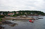
|File:Aaroysund.jpg)
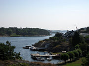
|File:Munkerekka.jpg)
|File:Tenvik_brygge.jpg)
Top Questions
AI generatedMore questions
Nearby Places
Nøtterøy
Former municipality in Vestfold, Norway

Kjøpmannskjær
Village in Færder, Norway
Skjerve
Village in Færder, Norway

Buerstad
Village in Færder, Norway

Torød
Village in Færder, Norway
Strengsdal
Village in Færder, Norway

Færder
Municipality in Vestfold, Norway

Torød Church
Church in Vestfold, Norway